
QUICK GUIDE
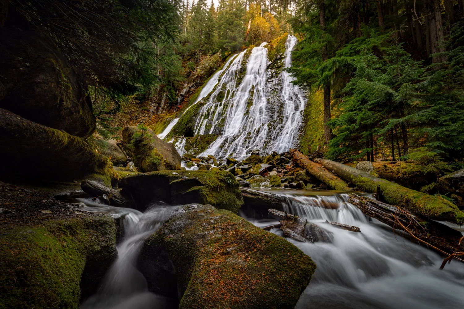
I haven’t had a chance to put together a full location guide yet, but I recently made it out to Diamond Creek Falls and wanted to share a quick guide while there may still be a chance to visit before too much snow arrives.
Diamond Creek Falls is reached by a forest loop starting at the Salt Creek Falls Observation Site in Oregon’s Willamette National Forest. The hike takes you above the Salt Creek canyon, past Too Much Bear Lake, and down a steep side trail to the base of a waterfall that spreads across a wide cliff. The loop is about three miles, with roughly 469 feet of elevation gain.
Quick Facts
- Difficulty: Moderate**
- Hike Length: Approx. 3 miles
- Elevation Gain: Approx. 469 ft.
- Hike Type: Loop
- Pass Required: Yes*
- When to Visit: Spring–Fall*
- Pets: Dogs on leash
- Kids: Older kids**
- Facilities: Toilets & picnic tables
*Main lot: $5 per vehicle or an accepted recreation pass. Check conditions before visiting, as snow or fires can change access. Winter Sno-Park parking has separate permit requirements.
**Expect uphill sections, steep edges, and a steep log stairway on the waterfall spur. Keep children close, especially on wet or slippery sections.
Getting there: Start at the Salt Creek Falls Observation Site, about 23 miles southeast of Oakridge and five miles west of Willamette Pass. Follow Highway 58 to the signed turn onto Forest Road 5893, then follow the signs to the parking area. The Diamond Creek Falls loop begins beyond the footbridge over Salt Creek. Bring drinking water, as there isn’t potable water at the site. Check Forest Service access information and current forest alerts before heading out.
My Experience
I finally made it out to Diamond Creek Falls recently, after stopping at Salt Creek Falls many, many times while driving Highway 58. I’d just never taken the time to hike the Diamond Creek Falls Trail. I’m really glad I finally did, especially while there was still some fall color.
The forest was gorgeous. We were there early in the morning, and everything was still a little wet from some rain. The loop follows ridges overlooking the valley where Salt Creek runs, and you also get to walk along Diamond Creek for portions of it. There was quite a bit more uphill than I expected. It’s rated moderate, but for me, it felt more on the moderate-to-hard side.
One of the early stops on our route was Too Much Bear Lake, which is definitely an interesting name for a lake! It was a beautiful little place to stop that morning, with autumn colors lining the shoreline. I’d come out here mainly for the waterfall, but the lake and the forest made the hike itself really enjoyable, too.
And then there’s Diamond Creek Falls. It was much bigger than I’d imagined, spreading across this huge, wide cliff and pouring down the rock face. A lot of the Oregon waterfalls I’ve been seeing lately haven’t had much flow, but this one was still running really well. From the photos I’ve seen, it seems to hold its flow pretty well through the year, though that can always vary.
The side trail down to the base was another memorable part. You descend a set of steps carved into a log, then continue down toward the creek and waterfall. The trail felt well maintained when I visited, but that descent is steep. Once you’re down there, you can get close to the bottom and look up at the water spreading down the cliff. There are some really beautiful views around the creek, too. Be careful if you explore for another angle, especially around wet rocks or moving water.
If you haven’t seen Salt Creek Falls before, I’d definitely encourage you to stop there before or after your hike. Even the short walk to the upper viewpoint is worth making time for.
If you can make it out before winter conditions settle in, I think it’s definitely worth a visit. People do hike and snowshoe out here in the snow, but with some of those steep edges and the stairs down to the falls, I’m not sure that’s something I’d be comfortable doing. The main observation site normally closes in winter, so access changes as well.
Overall, this was a really beautiful hike, and it’s worth keeping in mind if you’re driving Highway 58 and have a few extra hours. I plan to put together a full location guide as soon as I can. For now, I hope this helps you get out and see it!
Have you been here? I’d love to hear about your visit. Leave a comment at the bottom of the page and let me know what you thought!
Happy exploring 🌿
Trailhead Location
Nearby Locations
You Might Also Like
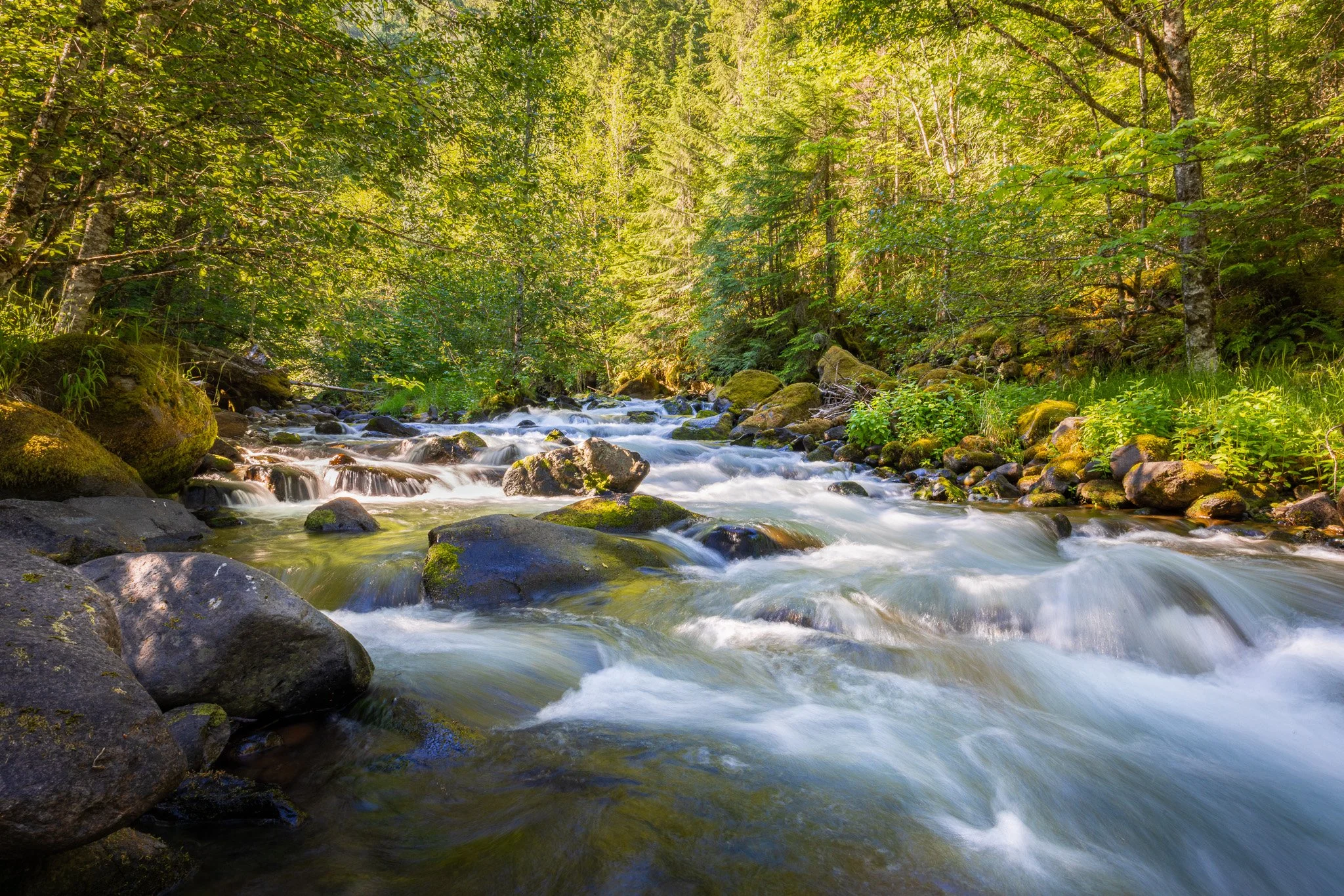
Salt Creek | Cinematic Nature Escape
Spend a little more time along Salt Creek with my Cinematic Nature Escape, featuring the creek, moss-covered rocks, and small cascades through the forest.