
MY BUCKET LIST
I haven’t visited this location yet. It’s on my bucket list, and I wanted to share a little information in case you get a chance to explore it before I do.
Alsea Falls and Green Peak Falls are connected by a forest trail in Oregon’s inland Coast Range. The walk follows the South Fork Alsea River and continues through the woods toward Green Peak Falls, giving you two different waterfalls to explore on the same outing.
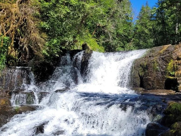
Alsea Falls in the Alsea Falls Recreation Site. Photo: Traci Meredith / Bureau of Land Management. Photo source · Public domain, U.S. Government work. No copyright claimed in the original U.S. Government work. Thumbnails may be cropped to fit.
This is a reference photo, not a current flow report. Check recent trail photos before your visit.
Why it’s on my list
Two waterfalls on one forest walk definitely sounds like a good reason to make the drive. I haven’t been to either of these yet, but the river, mossy rocks, and forest around them look like a really beautiful place to spend a little time.
I like that this isn’t a long hike, but there’s still more to see than a single roadside viewpoint. If you’re around Corvallis or the southern Willamette Valley, this looks like a good one to keep on your list. I’d definitely like to make it out here myself.
Have you been here? If you make it out before I do, I’d love to hear about your experience! Leave a comment at the bottom of the page and let me know what you thought.
At a glance
- Location: Near Alsea and Monroe, southwest of Corvallis
- Difficulty: Moderate
- Hike Length: Approx. 2.5 miles
- Elevation Gain: Approx. 288 ft.
- Hike Type: Out and back
View the trail and photos on AllTrails
Getting there: Start at the Alsea Falls day-use area off South Fork Road. BLM places the recreation site about 13 miles west of Monroe. The campground entrance is separate from the day-use entrance, so follow the signs for day use and waterfall access. The route to Green Peak Falls passes through McBee Park; follow the marked trail and respect any posted access notices.
Waterfall flow can change quite a bit through the year. Look through recent photos and trail reports before you go, especially after a dry stretch. Rain can make the roots, steps, and rocks slippery. BLM lists day use as open year-round, but check road conditions and posted notices before driving out. Cell service is limited, so save your maps ahead of time.
Details checked November 8, 2026. Trail measurements follow the linked AllTrails route. Sources: AllTrails, Bureau of Land Management, Oregon road conditions. Conditions and access can change.